
8 lost ancient cities that have never been found
The search for lost cities has often begun with a single, obscure story, either a drowned island described by Plato, a gold-covered ruler at Lake Guatavita, or rumours of an Inca refuge hidden somewhere beyond the Andes.
From the sixteenth-century expeditions that devastated South America to Percy Fawcett’s final journey into Mato Grosso, such tales drove men into landscapes that were incredibly dangerous that were barely understood by outsiders.
However, despite centuries of searching, the most famous lost cities are still a complete mystery, which has left historians and archaeologists with tantalising fragments of information about their existence.
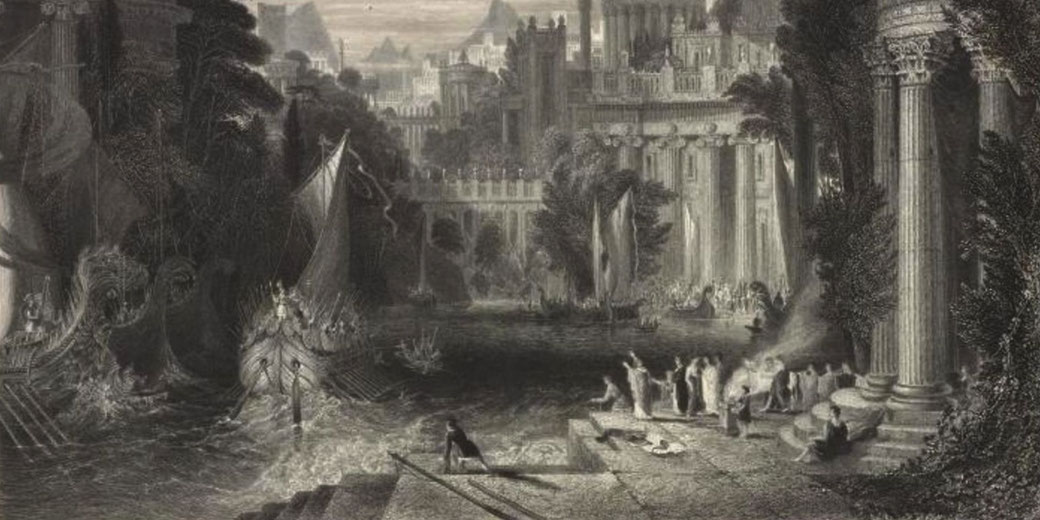
1. Atlantis
Of all the lost cities in history, Atlantis has held the strongest place in the Western imagination.
Around 360 BC, the Greek philosopher Plato introduced the idea in two dialogues called Timaeus and Critias, in which he described an advanced island civilisation that lay past the Pillars of Hercules, which was the Greek name for the Strait of Gibraltar.
According to Plato's account, the god Poseidon founded the island and made his son Atlas its king.
It is this story that gave the island its name and connected it to Greek ideas about Atlas and the Atlantic.
Plato described Atlantis as a powerful naval empire that was larger than Libya together with Asia Minor in ancient Greek geographical terms, and he said that it had conquered parts of Africa and Europe before it launched a disastrous campaign against Athens.
In Plato's story, the destruction of Atlantis supposedly happened 9,000 years before Solon's visit to Egypt, and the gods then destroyed it through earthquakes and floods in a single catastrophic day and night.
Importantly, Plato had been a philosopher rather than a historian, and most scholars today interpret the story as an allegory that was designed to explain his political and moral ideas.
Professor Thomas Kjeller Johansen has described it as a story invented about the past so that it could express a general truth about how ideal citizens should behave.
Plato had previously outlined an ideal state in his earlier work Republic, and the Atlantis story let him imagine how such a state might fare against a corrupt and aggressive rival.
Since the story appears only in Timaeus and the unfinished Critias, many modern scholars have treated it as didactic fiction rather than as a record of a real Bronze Age civilisation.
The legend, however, did not disappear. In 1882, former American Congressman Ignatius Donnelly published Atlantis: The Antediluvian World, which argued that Atlantis had been a real continent whose inhabitants had settled Europe, Africa, and the Americas.
Donnelly's book triggered a wave of popular interest that has continued to the present.
Since the nineteenth century, proposed locations for Atlantis have included the Greek island of Santorini, coastal Spain, Antarctica, the Caribbean, and Indonesia.
Modern plate tectonics, however, has shown that no large landmass could have sunk in the area Plato described because the ocean floor had spread over time rather than shrunk.
As archaeologist Ken Feder has argued, the geology leaves no room for a sunken Atlantic continent.
As such, Atlantis probably never existed anywhere except in Plato's imagination.
2. El Dorado
Over the other side of the Atlantic, a different lost city drew European explorers for more than two centuries.
El Dorado, which meant "the gilded one" in Spanish, came from a real Indigenous ceremony carried out by the Muisca people on the highlands of present-day Colombia.
When a new Muisca chief, who was known as the Zipa, took power, attendants covered him in fine gold dust and carried him by raft to the centre of Lake Guatavita.
There he plunged into the water as attendants cast gold and precious offerings into the lake to appease a deity that was believed to live beneath its surface.
Spanish historian Gonzalo Fernández de Oviedo y Valdés first recorded the story in 1541, and he described a great lord who went about continually covered in gold dust.
For the Muisca, gold held spiritual rather than material value because it was used as an offering to their gods.
Spanish conquistadors, however, interpreted the ritual as proof that an entire city of enormous wealth existed somewhere in the South American interior.
By the mid-sixteenth century, "El Dorado" had changed from the name of a golden chief into the name of a mythical golden city, and later it had become the idea of a golden kingdom hidden inland.
Explorers searched for it across Colombia, Venezuela, Guyana, and Brazil. In 1536, Gonzalo Jiménez de Quesada led an expedition up the Magdalena River with roughly 800 Spaniards together with Indigenous carriers and enslaved Africans, and nearly three-quarters of the expedition died during the journey.
He returned in 1569 with only a handful of survivors.
Among the most famous El Dorado expeditions were those led by the English soldier Sir Walter Raleigh.
In 1595, Raleigh sailed to Trinidad, captured the Spanish governor Antonio de Berrío, and travelled 400 miles into the Orinoco River basin without finding gold.
His second expedition in 1617 ended in disaster. His son Watt was killed in a clash with Spanish forces at Santo Tomé de Guayana, and Raleigh's subordinate Lawrence Kemys killed himself after he failed to secure forgiveness from his commander.
When Raleigh returned to England, King James I ordered his execution in 1618 because he had disobeyed instructions to avoid conflict with Spain.
The legend also drove repeated colonial attempts to drain Lake Guatavita in the hope of recovering treasure from the ritual offerings that had been cast into its waters.
In 1969, a small gold artefact discovered at Pasca near Bogotá confirmed that the ceremony had been real.
The "Muisca Raft," which was a 19.5-centimetre gold model that depicted the Zipa standing on a raft with attendants around him, now sits in Bogotá's Gold Museum as a national treasure.
3. The jungle city of Z
In the early twentieth century, British explorer Colonel Percy Harrison Fawcett became obsessed with finding an ancient civilisation that he believed had existed deep in the Amazon rainforest.
Fawcett was born in Torquay, Devon, in 1867, and he trained at the Royal Military Academy at Woolwich before he joined the Royal Geographical Society in 1901 to study surveying and mapmaking.
In 1906, the Society commissioned him to map the disputed border between Bolivia and Brazil, and over the following decade he completed seven expeditions through some of the most remote territory on earth.
During his travels, Fawcett discovered fragments of pottery together with other artefacts on the jungle floor, and these finds convinced him that a sophisticated urban settlement had once flourished in the Mato Grosso region of Brazil.
Fawcett named his hypothetical city "Z" and drew extra inspiration from a document known as Manuscript 512, which was held in the National Library of Brazil and which supposedly described a Portuguese expedition's discovery of ancient ruins in the province of Bahia in 1753.
The international attention that had been drawn to Machu Picchu by Hiram Bingham in 1911 strengthened Fawcett's belief that lost cities could indeed be found in the South American wilderness.
After a first attempt in 1920 had been stopped by fever and illness, Fawcett launched his final expedition on 20 April 1925.
He departed from the Brazilian city of Cuiabá with his eldest son Jack, who was aged 21, and with Jack's friend Raleigh Rimell.
The three men had with them two Brazilian labourers, two horses, and eight mules.
On 29 May 1925, Fawcett sent a final letter to his wife Nina from a place that he called "Dead Horse Camp," and he wrote that she should have no fear of failure.
After this message, the three men were never seen or heard from again. The Royal Geographical Society declared them officially lost in January 1927, and numerous rescue expeditions failed to establish their fate.
Various theories have been proposed, including murder by Indigenous groups, death by disease, and robbery by renegade soldiers who had been hiding in the jungle after a recent revolution.
Modern archaeology, however, has supported some of Fawcett's ideas. In the years after his disappearance, researchers discovered that the Upper Xingu region contained a network of substantial archaeological settlements, including Kuhikugu near the headwaters of the Xingu River, instead of a single isolated city.
In 2022, lidar surveys in the Llanos de Mojos identified major settlements of the Casarabe culture, which flourished from about AD 500 to AD 1400.
These included sites measuring roughly 147 hectares and 315 hectares, along with pyramids, causeways, reservoirs, and large-scale earthworks.
Such discoveries gave concrete evidence that advanced settlements had indeed existed in the Amazon.
4. Iram of the Pillars
Somewhere in the Arabian Peninsula, a city known as Iram of the Pillars has occupied Islamic tradition for more than a thousand years.
The Quran refers to Iram in Surah al-Fajr (89:6-14) and describes how God dealt with the people of ʿĀd, a tribe whose great stature was said to surpass that of people in other lands and which had been punished for corruption and for rejecting the prophet Hud.
According to Islamic tradition, the ʿĀd people had built a magnificent settlement with towering pillars, and their king, Shaddad, had become so wealthy and arrogant that he ignored the prophet's warnings completely.
As punishment, God sent a devastating sandstorm that lasted eight days, and it buried the entire city.
This disaster erased all trace of its existence beneath what is now the Rub' al Khali, or Empty Quarter, a 650,000-square-kilometre expanse of sand dunes that covered the southern third of the Arabian Peninsula.
For roughly 1,400 years, the account of Iram attracted scepticism since historical records outside the Quran contained almost no references to it.
In later centuries, Islamic scholars expanded the story. A narration attributed to Ka'ab al Ahbar, a Jewish rabbi who had converted to Islam in the seventh century, described Iram as a city made of gold and silver, and it had pillars of rubies or emeralds.
By the tenth century, Persian scholars had added further descriptions of saffron-scented gardens and great quantities of pearls.
The story reached a Western European audience through the One Thousand and One Nights, which included a spectacular retelling of Iram in Night 277 of the Arabic text.
People later nicknamed it the "Atlantis of the Sands," and the city drew the attention of explorers such as the British officer Bertram Thomas.
In 1930, his Bedouin guides showed him wide tracks between desert dunes and told him that they led to a city of legendary treasure that lay beneath the sands.
In the early 1990s, a team led by amateur archaeologist and filmmaker Nicholas Clapp announced that it had identified the lost city of Ubar, which the team equated with Iram, through the use of NASA remote sensing satellites, ground-penetrating radar, together with images taken by the Space Shuttle Challenger.
The site was at Shisr in the Dhofar province of Oman, and it contained pottery, walls, as well as the remnants of pillars dating to around 1000 BC.
Artefacts indicated that the settlement had come into existence during the Bronze Age, around 2800 BCE, and it appears to have been destroyed when a limestone cavern beneath it collapsed, perhaps between 100 and 200 CE.
Academic reaction, however, was mixed. Several scholars expressed hesitancy because the site was considered too small to qualify as a city, and archaeologist Juris Zurins preferred the view that Iram had been a region rather than a single settlement.
More recently, Safaitic inscriptions that mentioned both "Iram" and "ʿĀd" were found at Wadi Rum in Jordan, which had made efforts to pinpoint the city's location even harder.
5. Thule and the edge of the ancient world
Around 330 to 320 BC, a Greek explorer named Pytheas sailed north from his home city of Massalia, modern-day Marseille, and returned with an extraordinary account of a distant northern land that he called Thule.
Pytheas recorded his voyage in a work titled On the Ocean. That specific written work has since been lost entirely, which means that everything known about Thule has come from later Greek and Roman writers who quoted or disputed his claims.
Pytheas had been a scientist and navigator with astronomical knowledge, and he set out in search of amber plus tin or gold, all of which were valuable trading goods for the Greek colony of Massalia.
After he had mapped the coastline of Britain and had completely circumnavigated the islands, Pytheas continued north into waters that no Greek had previously entered.
According to the historian Polybius, who wrote around 140 BC, Pytheas described a region in which there was no proper separation between land and sea or air.
Instead, he described a mixture of all three that had the consistency of a jellyfish and in which one could neither walk nor sail.
Pytheas reported that Thule lay six days' sail north of Britain and that, during the summer solstice, the sun barely set.
He also described the inhabitants as humble farmers with fair complexions and light blond hair who lived on millet, herbs, fruit, and roots.
Since the people reportedly made drinks from grain and honey, they appear to have practised some form of agriculture in an extremely northern climate.
Pytheas's claims drew immediate doubts. Both Polybius and the geographer Strabo accused Pytheas of dishonesty and said that he had misled readers with fanciful stories, because the area he described was considered too far north for human habitation.
Strabo wrote that the northern limits of the habitable earth lay well south of the place where Pytheas placed Thule, and he dismissed the account as exaggeration.
However, Roman writers proved more receptive. Tacitus mentioned that a Roman fleet had sighted Thule past the Orkney Islands, and Pliny the Elder stated that there were no nights at all there during the summer months.
Around 37 BC, the Roman poet Virgil coined the famous phrase "Ultima Thule," meaning the farthest land, which turned Thule into a metaphor for the edge of the known world.
Since Pytheas's original text has been lost, identifying the actual location of Thule has proved impossible to settle.
Proposed locations have included Iceland, Norway, the Faroe Islands, Shetland, and the Norwegian island of Smøla, which a study by the Technical University of Berlin identified as a strong contender through ancient Greek and Roman maps.
Pytheas's descriptions of the midnight sun, impassable slushy ice, and thick fog suggest that he may have travelled as far as the Arctic Circle.
Oxford professor Barry Cunliffe, one of the leading scholars of the voyage, has favoured Iceland as the most plausible identification.
6. Kitezh, Russia's underwater holy city
On the shores of Lake Svetloyar, which was a nearly perfect oval lake in the Nizhny Novgorod Oblast of central Russia, a very different lost city legend has continued for centuries.
According to the story, Grand Prince Georgy II of Vladimir founded two cities in the early thirteenth century.
One was Maly Kitezh, or Little Kitezh, on the Volga River near present-day Krasny Kholm.
The other was Bolshoy Kitezh, or Greater Kitezh, on the shores of Lake Svetloyar in the forested interior.
Greater Kitezh had been established as a monastic settlement filled with white-stone churches together with golden-domed cathedrals and boyar palaces, and thick forest had hidden its location deliberately.
Apparently, people could reach it only by secret paths.
After Batu Khan, founder of the Golden Horde, had conquered much of the Russian lands in the late 1230s, he heard of Kitezh and ordered his army to advance towards it.
The Mongols first attacked and captured Maly Kitezh, and this forced Prince Georgy to retreat through the forests towards the larger settlement.
Batu Khan ordered his men to interrogate and torture Russian prisoners, and one captive eventually betrayed the secret paths that led to Lake Svetloyar.
When the Mongol army arrived at the walls of Bolshoy Kitezh, it found a city with no fortifications and no armed defenders.
The citizens had engaged in fervent prayer instead of preparing for battle, and, when the Mongols rushed forward to attack, fountains of water burst from the ground around the city.
According to the legend, the attackers watched in dismay as the entire settlement sank beneath the waters of the lake.
The last visible sight was the golden dome of the cathedral and the cross at its peak as both disappeared below the surface.
The first written reference to Kitezh appeared in the anonymous Kitezh Chronicle, a late eighteenth-century text that probably originated among the Old Believers, Russian Orthodox dissenters who separated from the official church after the reforms of 1666.
Importantly, the Chronicle does not state that the city disappeared into the lake. It says instead that the city suddenly ceased to exist after destruction in war.
The Old Believers later expanded the version in which the city lay beneath the water because they were drawn to the idea of a hidden sacred community where the righteous lived in prayer and where sinful outsiders could not enter.
Local tradition holds that only those who are pure in heart and soul can find Kitezh and that, on calm days, the sound of chiming bells plus singing can be heard rising from beneath the lake's surface.
In 1968, archaeologists Mark Barinov and Tatiana Makarova conducted a thorough investigation of Lake Svetloyar.
They examined the shoreline and used divers to explore the lake bottom, and they found no artefacts older than the nineteenth century.
Barinov proposed that a meteorite impact had originally formed the lake roughly 2,000 years earlier and that a shallower shelf that covered most of the lake bottom had formed about 800 years ago, which roughly matched the period of Batu Khan's invasion.
In 2011, the Vetluzhsky archaeological expedition uncovered traces of a medieval settlement on the hills beside the lake, including thousands of pottery shards plus fragments of iron knives and pieces of harness.
Archaeologist Evgeny Chetvertakov suggested that the original settlement had probably been small, perhaps a single homestead that housed ten to fifteen people, and that a landslide may have carried part of it into the lake.
This may have formed the basis of the disappearance legend. Composer Nikolai Rimsky-Korsakov made the story famous in his opera The Legend of the Invisible City of Kitezh and the Maiden Fevroniya, which premiered at the Mariinsky Theatre in St Petersburg on 7 February 1907.
The city still attracts pilgrims to Lake Svetloyar, and the path to the water is still known locally as the "Path of Batu."
7. Zerzura
In the western Sahara, somewhere between the Nile Valley and the Libyan Desert, Arabic manuscripts from the thirteenth century describe a hidden oasis city called Zerzura.
People knew it as "The Oasis of Little Birds," and they described it as "white as a dove." Zerzura was said to contain great treasure guarded by a sleeping king and queen.
The fullest early description appeared in the Kitab al Kanuz (The Book of Hidden Pearls), a lost fifteenth-century Arabic manuscript attributed to an anonymous author.
It instructed readers to follow a valley to the city's gate, where they would find a carved bird that held a key in its beak and that would unlock the entrance.
According to the text, black giants also guarded the city and prevented people from entering or leaving.
Some scholars believe that this detail may refer to the Tebu people, nomadic inhabitants of Chad and Libya whose ancestors raided oases across the Sahara.
The first European reference to Zerzura appeared in 1835, when the English Egyptologist John Gardner Wilkinson reported that an Arab who was searching for a lost camel had found an oasis five or six days west of the road to Farafra and that it contained palms, springs, and ruins of uncertain date.
Wilkinson's account was considered credible because later explorers successfully located several other oases that he had mentioned in the same work.
During the 1920s and 1930s, a new generation of European explorers turned its attention to the Sahara's uncharted interior.
The British explorer Ralph Bagnold and the Hungarian aviator László Almásy led a joint expedition from 1929 to 1930 in Ford Model A trucks and searched the desert for Zerzura.
In 1932, the Almásy-Patrick Clayton expedition used reconnaissance flights to find two valleys in the Gilf Kebir plateau, and, in the following year, Almásy found a third wadi that contained rain-fed oases in the remote desert.
Whether these wadis were the legendary Zerzura proved contentious. Bagnold considered Zerzura a general legend that no single discovery could solve, and he wrote that it was one of many names given to fabulous cities that the Sahara had created in the minds of people to whom it was barely accessible.
Almásy later became the inspiration for Michael Ondaatje's 1992 novel The English Patient, and he continued to believe that the wadis were tied to the ancient legend.
He held this view especially after he had found prehistoric cave paintings in the Gilf Kebir that depicted swimmers and suggested that the region had once been fertile and well-watered, thousands of years before the Sahara turned into desert.
After their return in 1930, the people involved in the search for Zerzura founded the Zerzura Club in a bar in Wadi Halfa, and many of its members later became officers in the British Army during the Second World War.
Bagnold later created the Long Range Desert Group, which collected intelligence behind enemy lines in North Africa.
Almásy worked for the German side and guided spies through the desert towards Cairo.
As a lost city, Zerzura is particularly strange because the Sahara's climate had changed so drastically over the millennia.
Satellite imagery has revealed ancient riverbeds together with geological formations beneath the sand, and these findings confirm that the desert once supported communities and agriculture.
If Zerzura existed as a real settlement, it may have thrived during one of the Sahara's wetter periods and then gradually disappeared under encroaching sand as the climate dried.
Whether it had been a single city, a network of oasis settlements, or a myth that grew from travellers' tales about scattered desert refuges, the white city of the Sahara has never been identified with certainty, and the sands still conceal whatever may lie beneath them.
8. Paititi and the last great refuge of the Inca
As the Spanish conquest tore through the Inca Empire during the 1530s, rumours began to circulate among indigenous communities and European invaders that a hidden city of extraordinary wealth lay concealed somewhere in the dense rainforests east of the Andes.
Known as Paititi, this legendary Inca settlement allegedly lay hidden in the remote jungles at the meeting point of southeast Peru, northern Bolivia, and northwest Brazil.
In the aftermath of the conquest, Manco Inca Yupanqui, who was one of the sons of the late emperor Huayna Capac, initially cooperated with the Spanish before he led a major revolt in 1536.
After he had abandoned the fortress of Ollantaytambo, Manco retreated farther into the wilderness and eventually reached the remote jungles of Vilcabamba, where he established the Neo-Inca State in 1539.
Vilcabamba lay in a remote area approximately 100 miles west of Cusco, and during the following three decades it was used as a base for raids against Spanish forces.
The resistance continued through Manco's sons, Sayri Túpac and Titu Cusi Yupanqui, until the Spanish Viceroy Francisco de Toledo declared war on the Neo-Inca State and sent troops to conquer it.
On 24 June 1572, the Spanish entered Vilcabamba and found it deserted and entirely destroyed because the last Inca ruler, Túpac Amaru, had fled into the lowland forests the previous day.
Túpac Amaru was later captured, brought back to Cusco, and beheaded on 24 September 1572, which officially ended organised Inca resistance to Spanish rule.
Even so, the fall of Vilcabamba did not extinguish the idea of an Inca refuge. In 1681, the Jesuit missionary Fray Lucero spoke to indigenous communities in the Río Huallaga area of northeastern Peru, and they told him that the lost city of Gran Paititi lay behind the forests and mountains east of Cusco.
According to Lucero's account, the inhabitants of this hidden city were descendants of Inca Túpac Amaru, who had supposedly fled into the forests with 40,000 followers and a rich treasure during Pizarro's initial conquest.
An earlier reference dated to 1600, when the missionary Andrés Lopez wrote to the Vatican and claimed that he had learned of a lost city containing gold from indigenous Peruvians in the Amazon.
In Andean oral tradition, the Paititi legend also revolved around the culture hero Inkarri, who was said to have retreated toward the jungles of Pantiacolla after he had founded the communities of Q'ero and Cusco, and he was believed to have lived out his days in the refuge city of Paititi.
Expeditions to find Paititi were costly and often fatal. In 1971, a French-American expedition led by Bob Nichols, Serge Debru, and Georges Puel travelled up the Río Pantiacolla from Shintuya.
After their guides had departed, the three men continued alone into the jungle and were never seen again.
Japanese explorer Yoshiharu Sekino later confirmed through contact with the local Machiguenga people that the expedition members had been killed.
In 1997, Norwegian explorer Lars Hafskjold set out from Puerto Maldonado in the Madre de Dios region and disappeared somewhere in the unexplored parts of Bolivia.
More successful, though still inconclusive, were the expeditions of American psychologist Gregory Deyermenjian, who documented significant Inca ruins between 1984 and 2011 along branches of an ancient stone road in the Pantiacolla region, including the agrarian settlement of Mameria.
French-Peruvian explorers Nicole and Herbert Cartagena had discovered Mameria in 1979.
The site contained approximately 15 square miles of houses built in the pirca style that was typical of Inca construction, and this provided the first written proof of Inca presence within the Peruvian Amazon jungle.
In 2004, Deyermenjian's team discovered further Inca ruins at a peak known as Último Punto in the northern Pantiacolla region.
French explorer Thierry Jamin also studied petroglyphs at the site of Pusharo and reported that he had discovered geoglyphs in a nearby valley which he believed could have worked as a map indicating Paititi's location.
In 2017, four local guides found stone structures that resembled Inca buildings in the jungle north of Cusco near a flat-topped mountain, which satellite imagery had already flagged as a possible site.
Since 2017, the international Paititi Research project has used Geographic Information Systems technology together with satellite imagery and traditional fieldwork to narrow candidate locations for the city.
After it had investigated six potential sites, the team focused its efforts on a single candidate and had been working toward the publication of its findings in a peer-reviewed journal.