
The British were not the first Europeans to discover Australia
In 1770, Captain James Cook landed at Botany Bay and claimed the eastern coast of Australia for Britain. His detailed observations and accurate maps helped lay the foundations for colonisation, and his journey became the most widely taught version of European contact with the continent.
However, over 160 years earlier, Dutch explorers had already charted large sections of the Australian coastline, and other Europeans had likely encountered this large area of land well before Cook’s famous arrival.
The dutch and the early mapping of Australia
During the early 1600s, the Dutch East India Company (VOC) had been established in 1602 and came to control much of the shipping traffic across the Indian Ocean.
In order to shorten the voyage between the Cape of Good Hope and Batavia, Dutch captains took advantage of strong westerly winds that pushed them into more southern latitudes.
As a result, they encountered stretches of unfamiliar coastline that belonged to the land later named Australia.
In 1606, Willem Janszoon, who commanded the Duyfken, sailed south from the Dutch East Indies and reached the western coast of Cape York Peninsula.
He followed the coastline for approximately 320 kilometres, recorded interactions with Aboriginal people near the Pennefather River, and mistakenly believed the land formed part of New Guinea.
After violent encounters and a lack of obvious trade opportunities, he returned because he did not realise that he had encountered a separate continent.
The VOC gave little attention to his report, and no immediate follow-up expedition occurred directly in response, although Dutch voyages continued in later years.
Over the next several decades, other Dutch explorers charted additional sections of Australia’s western and southern coastlines.
In 1616, Dirk Hartog landed on the island that now bears his name and left behind a pewter plate as a record of his visit.
His arrival at Shark Bay confirmed the existence of a very large area of land to the east of the Dutch spice routes.
In 1619, Frederik de Houtman sighted the western coast, while in 1627 Pieter Nuyts and François Thijssen sailed aboard the Gulden Zeepaert, and they charted parts of the southern coastline, which included the Great Australian Bight.
From 1606 to 1644, VOC ships expanded European knowledge of the region, and European mapmakers began to label the land as "New Holland."
His voyage led to the European discovery of Van Diemen’s Land, later renamed Tasmania, and confirmed that the southern land reached further south than people had thought before.
In 1642, Abel Tasman had departed Batavia with instructions to investigate the unknown southern waters, but it was his second voyage in 1644 that produced one of the most complete Dutch maps of northern Australia at the time.
However, his failure to locate a large commercial port or inland resources discouraged further interest from VOC officials.
For that reason, the Dutch abandoned the idea of colonisation, and they viewed the territory as not financially worthwhile and not worth further expense.
The terrible shipwreck of the Batavia in 1629 off the Western Australian coast, which was followed by mutiny and massacre among the survivors, further reinforced the image of the continent as dangerous and very hard for Europeans to live in.
Portuguese theories and cartographic traces
By the early 1500s, Portuguese ships had reached Timor and had maintained contact with trade networks across the eastern Indian Ocean.
Given their proximity to northern Australia, several historians have suggested that Portuguese sailors may have reached the continent even earlier than the Dutch.
Although no direct logbooks or recorded landings survive, some indirect clues have led to ongoing debate.
Among the main sources that people discuss are the Dieppe Maps, which were drawn in France during the 16th century by cartographers such as Jean Rotz and Pierre Desceliers and which show a large area of land labelled "Jave la Grande" positioned in what appears to be northern Australia.
The labels and style suggest Portuguese origins, and this has led to theories that the maps were based on earlier Portuguese charts no longer in existence.
Some scholars argue that the Portuguese may have kept such discoveries secret to protect their commercial interests.
Occasionally, physical evidence has appeared to support these possibilities. A bronze cannon once believed to be Portuguese was discovered on Carronade Island, and several old coins that were found along the northern coast have been proposed as signs of early European activity.
However, more recent analysis suggests the cannon may not be Portuguese in origin, and the coins may have arrived via Makassan traders or later shipwrecks.
Since no direct written records exist, most historians treat the theory with caution.
Even so, the evidence suggests that knowledge of a southern continent spread among European navigators well before the more famous voyages of the 17th century.
Spanish navigators and the Torres Strait
During the early 1600s, Spain also sent expeditions into the Pacific. In 1605, Pedro Fernández de Quirós led a voyage from Peru aimed at locating Terra Australis, which was an imagined southern continent.
After Quirós abandoned the mission due to illness, command passed to Luís Vaz de Torres, who continued westward and eventually sailed through the strait that now bears his name.
Based on the position of his route, Torres likely saw parts of northern Australia, particularly the tip of Cape York Peninsula, when he passed through the strait in October 1606.
While his surviving reports mention signs of land to the south and dangerous reefs, they include no confirmed description of the Australian mainland.
Spanish interest quickly turned back to protecting the Manila Galleon trade route, and Torres’ passage attracted little attention outside Iberian archives.
British historian Alexander Dalrymple later uncovered these documents in the 1760s, and this helped renew interest in Torres’ voyage.
Roughly 150 years after the voyage, British historians eventually recovered the details from the Spanish archives.
Although Spain had passed near the Australian coast, it had no intention of establishing settlements or charting its geography in detail.
As a result, its early closeness to Australia had no lasting impact on the continent’s European history.
The British arrival
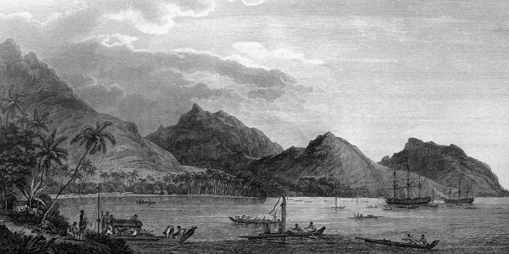
In April 1770, Captain James Cook reached the eastern coast of Australia during his first Pacific voyage aboard the Endeavour.
Backed by the Royal Society and the British Admiralty, Cook’s expedition aimed to observe the transit of Venus and, under secret orders, to explore unknown southern lands.
After he anchored in Botany Bay, Cook continued north, and he charted the coast with very high accuracy and claimed New South Wales for Britain when he raised the Union Flag at Possession Island on 22 August 1770.
Cook’s voyage differed from earlier European expeditions in several key ways. He documented the journey in great detail, collected scientific observations, and produced reliable maps that supported later colonisation.
Banks later advised the government on selecting Botany Bay as a site for future settlement, though it was eventually abandoned for Port Jackson due to its better conditions.
Naturalist Joseph Banks and his assistant Daniel Solander had gathered thousands of specimens and created interest among scientists and government officials.
When Britain looked for a location for penal transportation after losing its American colonies, Cook’s charts provided a practical solution.
After the arrival of the First Fleet in 1788 under Governor Arthur Phillip, the British began promoting Cook as the "discoverer" of Australia, and as a result his name became central to the founding story of the colony.
Earlier Dutch and Iberian explorations largely faded from public memory, since Britain had established permanent control and its narrative replaced earlier histories, which remained buried in academic records and museum collections.